Wise Pilgrim
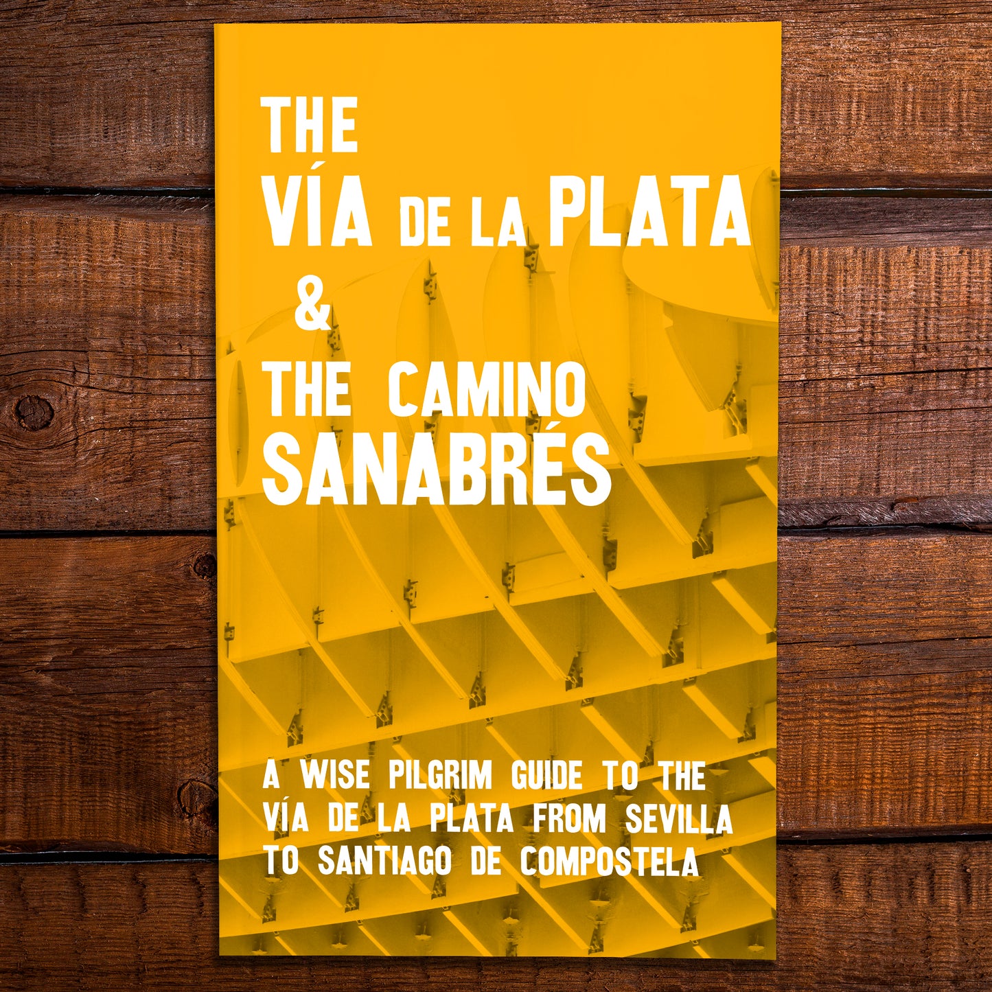
The Vía de la Plata and the Camino Sanabrés - A Guide to the Camino from Sevilla to Santiago.
The Vía de la Plata and the Camino Sanabrés - A Guide to the Camino from Sevilla to Santiago.
Couldn't load pickup availability
Each book ordered will include (at no extra cost):
- 1 "Camino Passport" (from the Cathedral in Santiago)
Comprehensive accommodation directory: Hundreds of properties, including all albergues, hotels, paradors, casa rurales, pensions, and camp sites.
For albergues you will know: how many beds (including private rooms) the albergue has and how much they cost, phone number, months (and hours) open, and whether the albergue accepts non-pilgrims or reservations.
You will also know whether they have a bar/restaurant, a kitchen for your use, whether they serve a group dinner, have vegetarian options, wifi, laundry facilities, or bicycle storage.
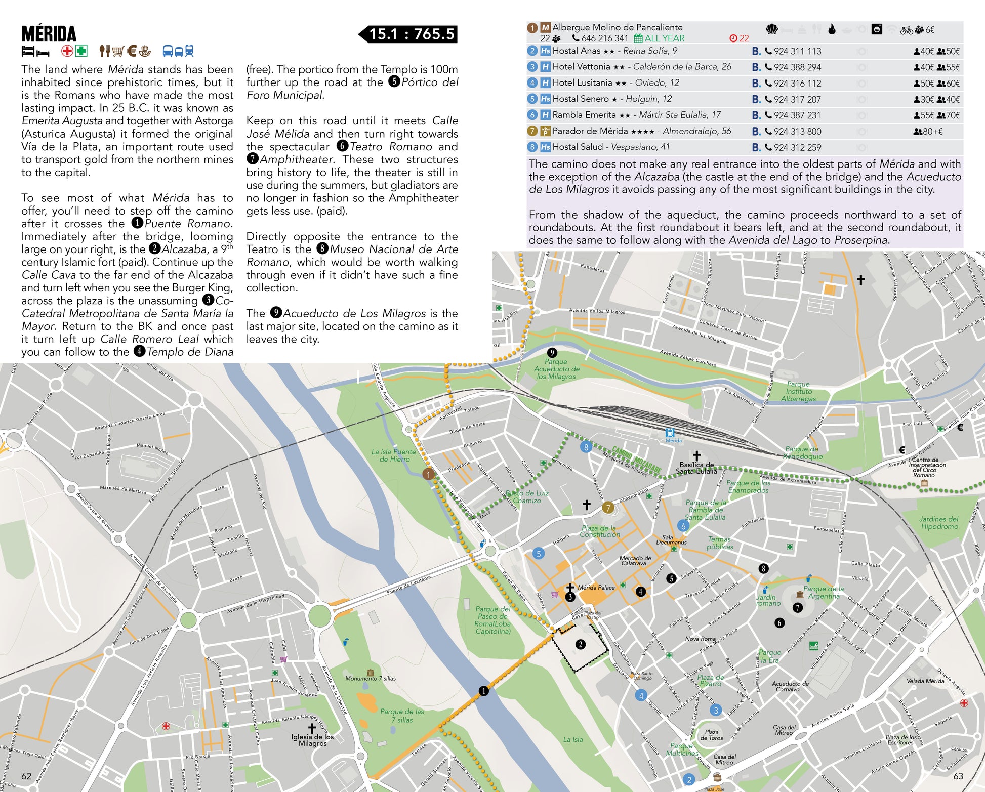
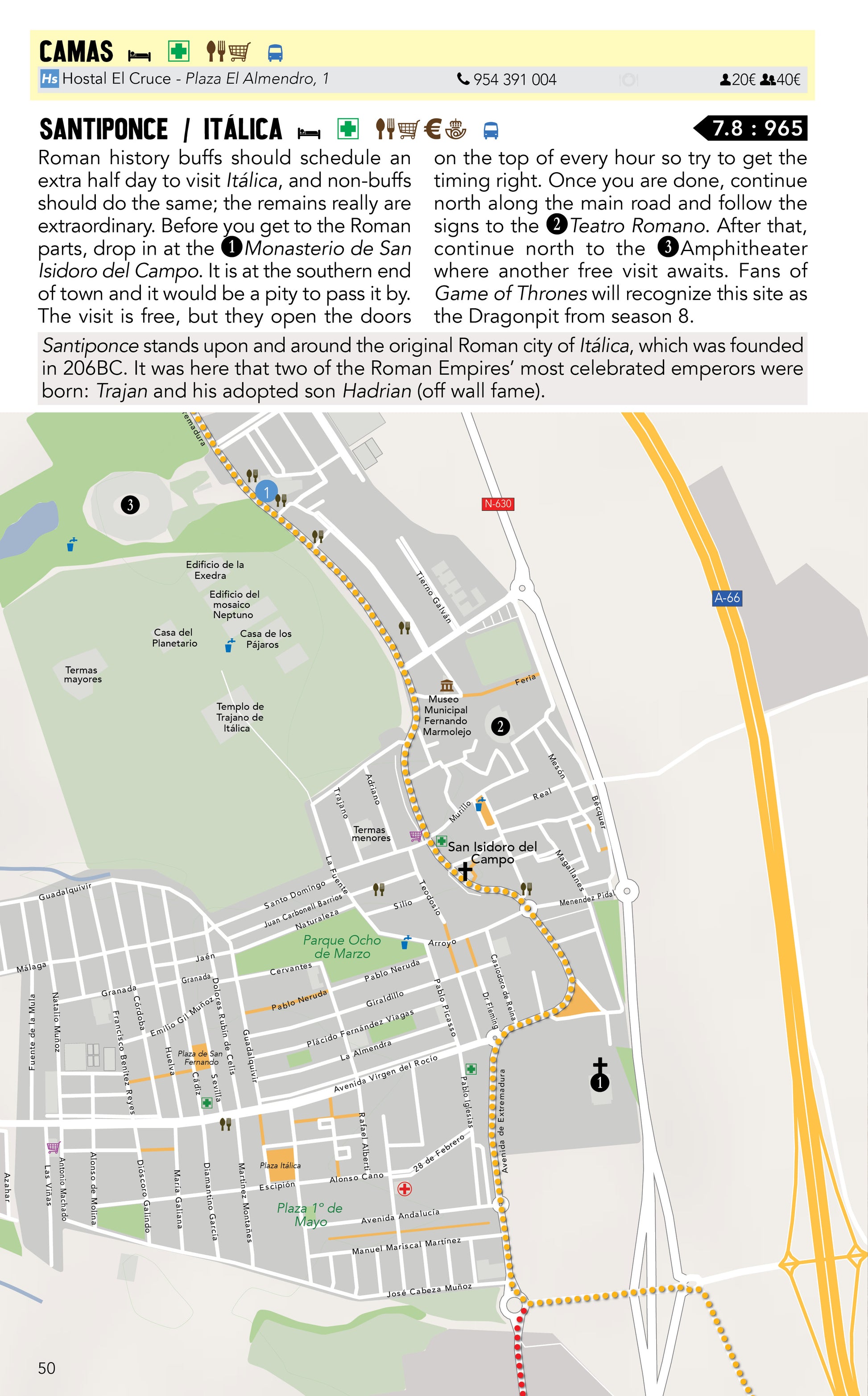
City by city information: Navigation tips and cautions, historical references, a list of available service (pharmacies, restaurants, atms, that kind of stuff) and dates for local fiestas.
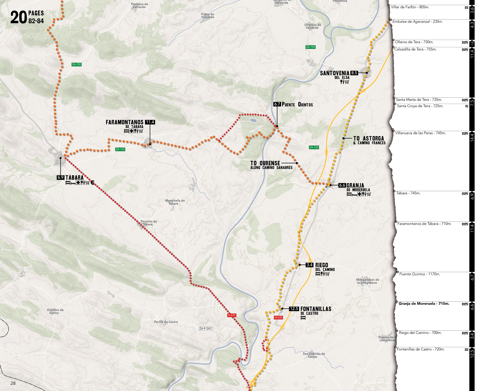
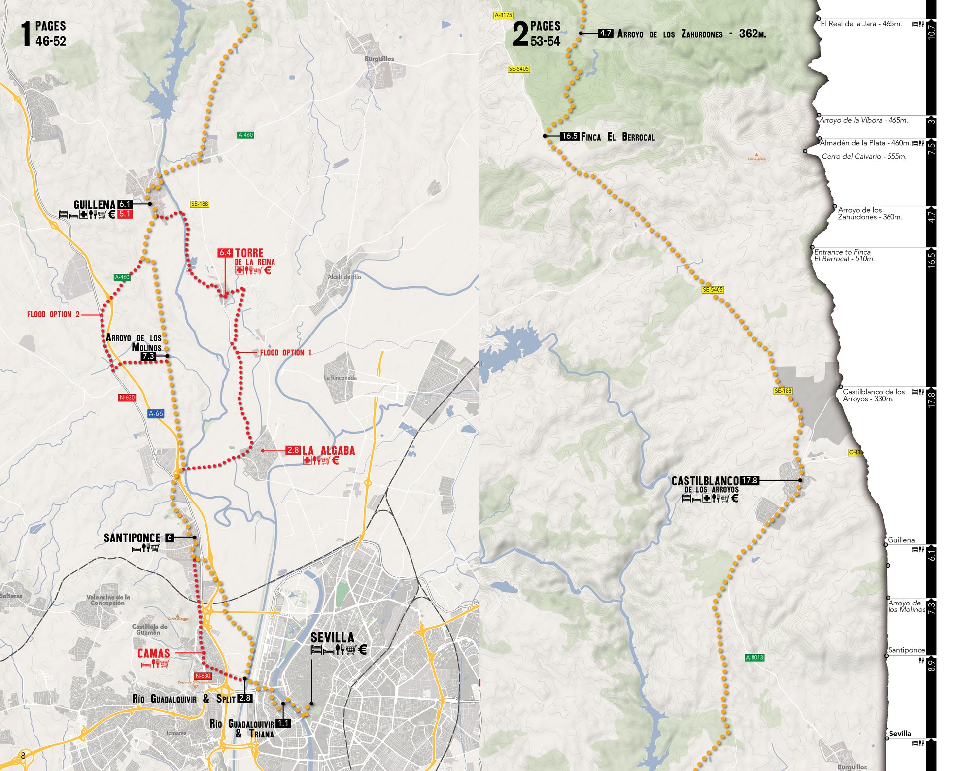
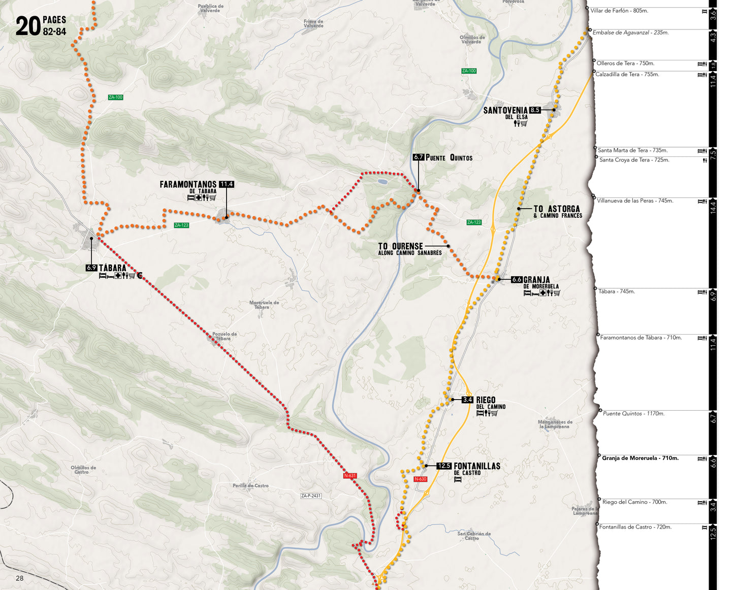
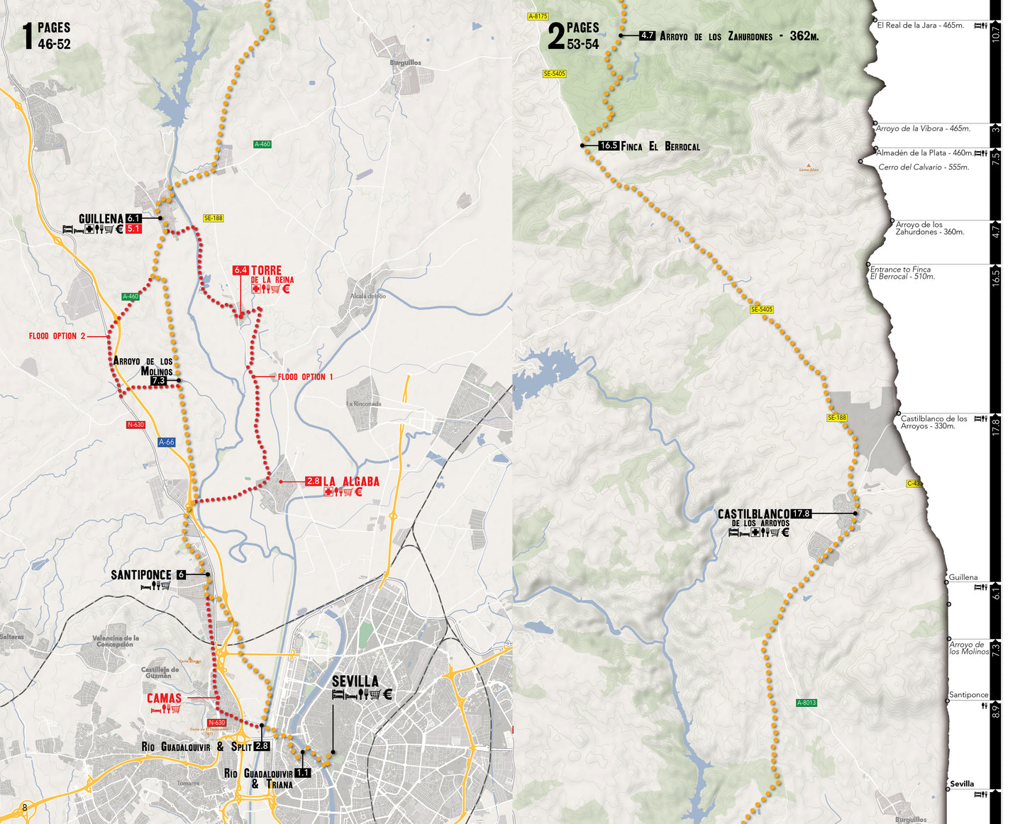
Large Scale Planning Maps: Large Scale Maps with no pre-determined stages. These maps are at the start of the book and are the best reference for anyone wanting to plan ahead without having to flip through the book.
Elevation Profile: The elevation profile sits alongside the large scale maps, giving you a better overview of the terrain ahead.
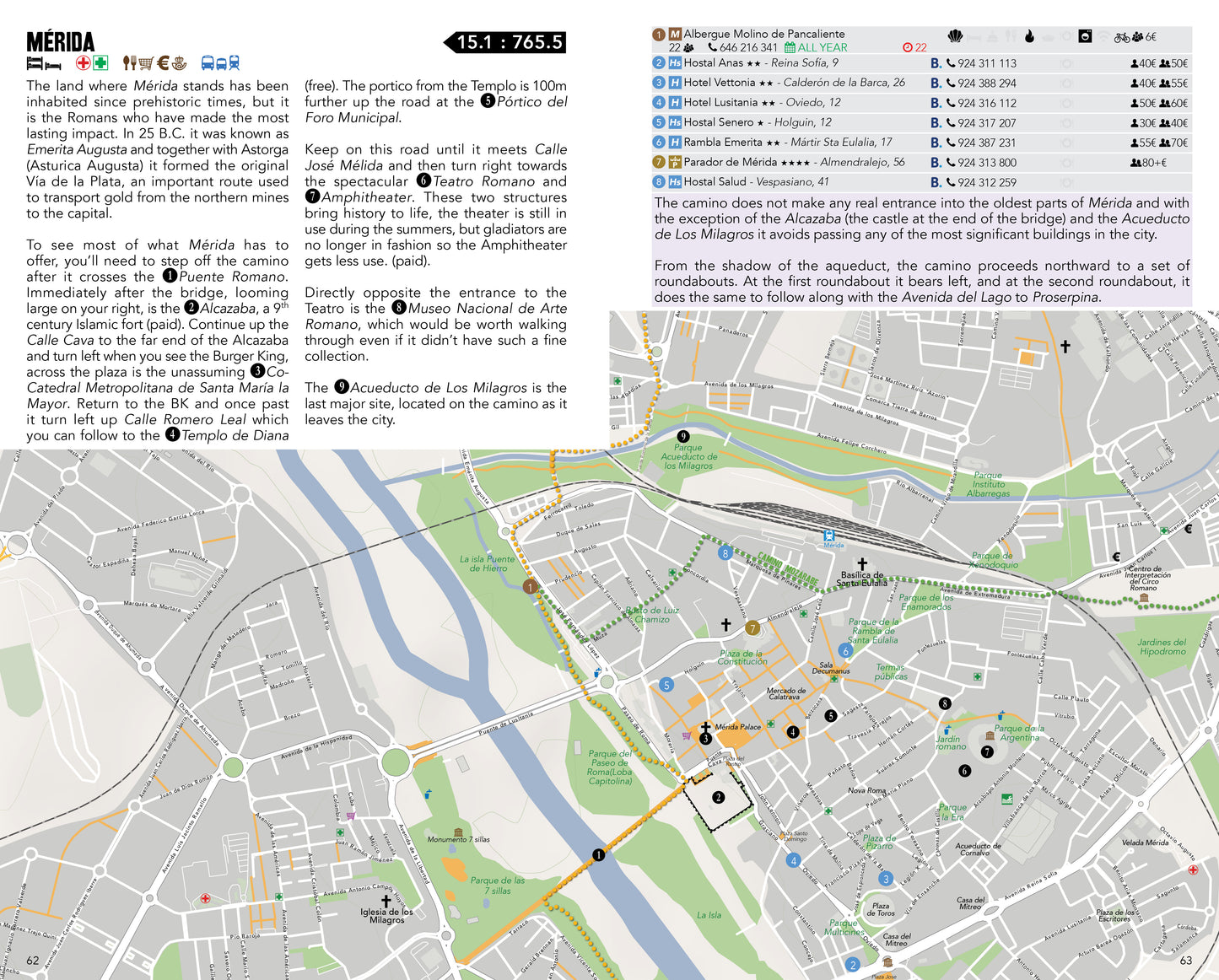
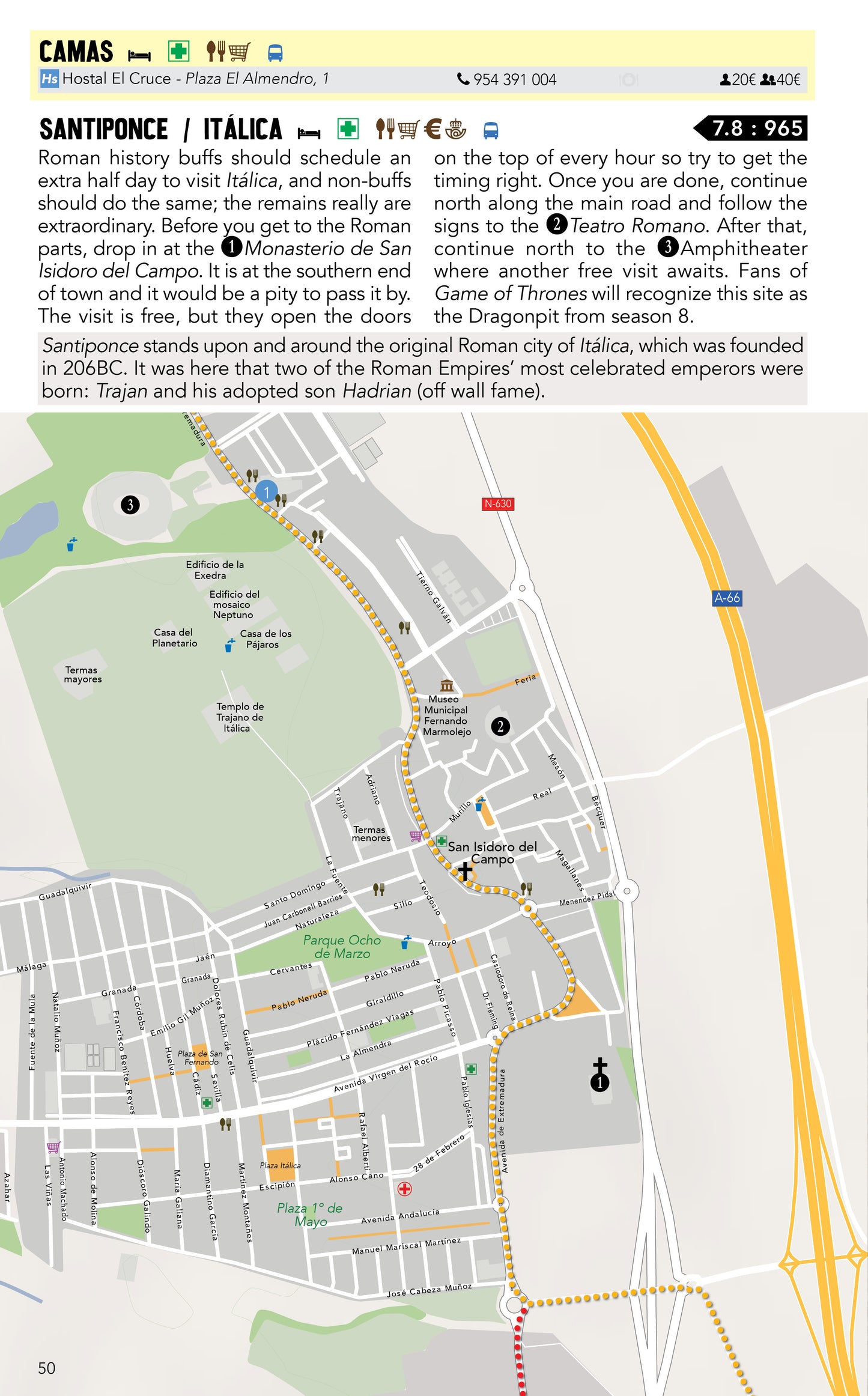
City Maps: Lots and lots of city maps. From the small villages to the regional capitals, if there is more than one option for accommodation a map is included to help you find it. These maps are inline with the guide and also show the nearest grocery, albergue, pharmacy, atm, and other bits.
Share
This will be a useful guide for planning our stage from Salamanca to Astorga in 2026
As expected.
Having done five caminos over the last 23 years this looks to be the best guide book I’ve ever had, can’t wait to start walking.
The Vía de la Plata and the Camino Sanabrés - A Guide to the Camino from Sevilla to Santiago.
think it should be big help when i do vdlp in march april 2025 have had initial look and seems what i need to get started
